Pages

Second public consultation for Greenway in the Skibbereen area - July 2024


There are a number of Greenway projects planned for County Cork and one of these is in West Cork taking in the towns of Skibbereen, Drimoleague, Baltimore & Schull.

In February of 2024, an initial public consultation was carried out and the project area is shown below.


This was more about getting feedback on the proposed Greenway project without going into too much detail about the specific route.

Here are some of the key points from the first public survey...

A. Distances - Skibbereen to Baltimore (13km) - Skibbereen to Schull (23km) - Skibbereen to Drimoleague (13km)

B. There were 644 submissions of which 63% were women.

C. Feedback was very positive and 96% expressed an interest in using the Greenway.

D. Road safety and traffic levels was mentioned as a reason for using a Greenway in about 50% of the submissions.

E. A Greenway from Skibbereen to Schull and Baltimore are the most popular options with fewer choosing the link to Drimoleague.

The second public consultation is open until Friday 26th of July 2024.

The route choices have now been narrowed down as can be seen from the map below.


If you are interested in making a submission or want to look at the documents for the project then go to https://wcgskibbereen.ie/publications/

These Greenway projects tend to move at a glacial pace but the end result show be safer areas to run and train. This is especially true in or near towns where a lot of roads are like rat runs for cars and can be unsafe.

I had a look at satellite images for the area concerned and the old railway route is now largely gone. It's not like the case in East Cork where the track of the old railway line from Midleton to Youghal was largely intact. 

It's very likely all of these Greenway projects will link up and it will hopefully be possible to go from Cork City to Schull without using a public road.

A full timeline for the Skibbereen project is shown below...


Dutch regulator issues safety warning about Babboe Cargo Bikes - 28th Feb 2024


According to the Guardian Newspaper, the Dutch regulator for consumer product safety (NVWA) has called for a temporary halt to trading by Babboe, which makes cargo bikes, “because their safety cannot be sufficiently guaranteed”.

The NVWA demanded the Dutch company, which describes its product as “the worldwide number one cargo bike”, recall two models and issue public safety warnings over several others. The mass recall in the Netherlands is understood to affect about 10,000 cargo bikes.

Full story here... https://www.theguardian.com/news/2024/feb/28/dutch-cargo-bike-firm-babboe-ordered-to-halt-sales-amid-safety-concerns

Vernon Mount Greenway finally opens - 1st Nov 2023


After what seems like an eternity, the new Greenway connecting Frankfield & Grange to the Tramore Valley Park has finally opened.

The new path is about 1km in length and goes from the church in Frankfield to the southern entry point for the Tramore Valley Park.


This is a photo taken on the 1st of November 2023 showing the new ramp up to the bridge and a signpost.


The surface of the ramp and the bridge over the South Ring Road has a rough texture which be vital in icy weather when tarmac is like glass.


The path up to Frankfield as a nice smooth tarmac finish with some gentle curves. The gradient is modest and nothing worse than many other hills around the city. I'd estimate that it's in the range of about 6-8%.


Close to the Frankfield end, the path splits into two options. In the photo shown above, there is a series of steps on the left and on the right, there is a more gradual gradient with several switchbacks.


The photo above shows the other end of the steps looking towards the Tramore Valley Park. 


This photo gives a nice overview of the two paths.


The photo above shows the entrance of the walk on the Grange Road. This is directly across from the church in Frankfield and was an area known as the Donkey Field.

Options... On the south side of the Vernon Mount Bridge, there is also a new entrance from the Alden Grove estate.


This should give a few more route options.

In Summary... The Tramore Valley Park is now a major recreation area in the city and this new Greenway improves access. It should give cyclists a few more route options around the city.

Recycle Your Bike Scheme in Cork - Oct 2023


The Cork County Council Environment Department announced the following...

🚴‍♀️ Did you know that bicycles collected at Cork County Council recycling centres are often given a second life?

♻ Cycle Sense and Sign & Cycle collect and refurbish the bicycles before distribution back into the community. For more information visit

www.signandcycle.com / www.cyclesense.ie

Take action to meet Sustainable Development Goal 12, Responsible Consumption and Production by bringing unwanted bicycles to your local recycling centre or purchasing a refurbished Relove Bike.

Blackwater Valley Cycle Route - Maps & Signs - Fermoy to Doneraile


The Blackwater Valley Cycle Route goes from Midleton in East Cork to Rathmore in Co Kerry and covers a distance of about 160kms. This was a tourist initiative launched around the turn of the century.

More info in this overview post.

In this post, we'll look at the section from Fermoy to Doneraile which is about 30kms long. We'll look at what old maps and signs are still present on the route as of August 2023.

As can be seen from the map above, the route goes from Fermoy to  Glanworth to Castletownroche and then on to Doneraile. Large parts of this section are on nice quiet country roads with views of the mountains in the distance.

For information on the signs in Fermoy, see this earlier post.

Glanworth - Map Board : The information sign for the route is opposite the church in the village.


This another view showing the route ahead through the village and the sign on the right.


The sign is a little unusual in that it is facing away from the passing cyclist. The front of the board is shown below.


This is a close up of the map which shows the route from Fermoy to Castletownroche.


Signs west of Glanworth : At the north side of the village of Glanworth, the route takes a left and west onto a quiet country road. There are several junctions along this section and they have direction signs along the way.


The first direction sign at junction 'A' is shown below...


The sign is a little bit battered but still in good condition.


The direction sign at junction 'B' is above the yield sign.


It's still in a reasonable condition.


This is the only section of this part of the route where a little care with navigation is needed. Take a left at the junction 'B' and then a right at the crossroads at junction 'C'.


The sign shows some sign of damage but it's still present.


Castletownroche - Map Board : The information sign for the route is located just in front of the random wall in the village of Castletownroche. It seems a bit unusual in that it's not really near any landmark other than the fact it's about 100m west from the bridge over the River Awbeg.


This is a view of the notice board.


This is the map in more detail showing the route from Glanworth to Doneraile.


After a right turn in Castletownroche, it's onto a quiet country road again until Skenakilla Cross where the cyclist meets the busy N73 road. This only lasts for about 100m before turning left for Doneraile (6.3kms) on a moderately busy road.

Approach to Doneraile... There are a number of signs along this approach road to Doneraile.


At 2.5kms to Doneraile, come to junction A. The image below is from Google Streetview dated 2019 which shows two brown direction signs...


I'm not sure what the current status of the signs are. I passed here in August of 2023 so perhaps I took a photo and it didn't record it, the signs were gone or I just missed them.

Junction B is 2.2kms from Doneraile and passes a road on the right.


Either side of this junction, the two brown direction signs are still present as of August 2023.

Junction C is 1.1kms from Doneraile and passes a road on the left.


This photo from August 2023 shows a pole on the right which used to have brown direction arrows on it. According to Google Streetview, these went missing between July 2019 and October 2021.

Arriving in Doneraile... On arriving in Doneraile, the cyclist comes to a t-junction where the road joins the R581.


The brown Blackwater Valley Cycle Route signs can be seen on the right.


This is a closer view.

Doneraile - Map Board : The information sign for the route is located in the village just north  of the bridge over the River Awbeg.


The Blackwater Valley Cycle Route sign can be seen on the far right while there is a more modern and larger Ballyhoura Cycle Routes sign to the left of it. 

The sign is showing its age and is a bit dirty but at least it's still there.

The image above shows a close up of the map. Once the cyclist reaches Doneraile, they are presented with a choice. 

Option 1 is the northerly route going through Buttevant and heading towards Kanturk. Option 2 heads south to the large regional town of Mallow and then onto to Ballyclough and Kanturk.

Leaving Doneraile : About 500m north of the bridge and sign in Doneraile, there is one more route sign at Turnpike Cross. This is the junction of the R581 and R522 roads.


There are plenty of different signs here but the photo below taken in August of 2023 shows the Blackwater Valley Cycle Route sign on it's own.


The sign on the right points south back towards Doneraile and that's correct. The sign on the left however is pointing in the wrong direction. 


It's pointing north whereas it should be pointing west towards Buttevant.

Looking at the images on Google Streetview, it was pointing in the correct direction in May of 2011. In the image dated August 2019, it is pointing in the wrong direction as it is now in August of 2023.

The signs also look remarkably clean despite being so old. This may likely be due to a very active Tidy Towns group in the village.

In Summary... Despite the age of the route, all of the notice boards and maps are still present in Fermoy, Glanworth, Castletownroche and Doneraile. Out of entire route from Midleton to Rathmore, this is the section where the maps and signs are in the best condition.

For more information on the entire route, see the overview post.

Blackwater Valley Cycle Route - Maps & Signs - Youghal to Fermoy


The Blackwater Valley Cycle Route goes from Midleton in East Cork to Rathmore in Co Kerry and covers a distance of about 160kms. This was a tourist initiative launched around the turn of the century.

More info in this overview post.

In this post, we'll look at the section from Youghal to Fermoy which is about 48kms long. We'll look at what old maps and signs are still present on the route as of August 2023.

As can be seen from the map above, the route goes from Youghal to Mount Uniacke and Ballynoe on reasonably quiet roads. After Ballynoe, it starts off quiet but it joins the busy R628 road to the east of Conna. The route follows this busy road until the crossroads at Aghern where the route turns right onto mostly quiet country roads as far as Fermoy.

For information on the sign in Youghal, see this earlier post.

Mount Uniacke - Map Board : The information sign for the route is located at a junction at the south-eastern approach to the hamlet of Mount Uniacke.


This is the notice board in more detail...


This is the original map cleaned up a bit to make it clearer....


Ballynoe - Map Board : The information sign for the route is located outside the community centre in Ballynoe.


This is another view of it...


This is a close up of the map on the notice board.


Ballynoe to Conna Road Junction : About 2kms to the north of Ballynoe, there is a second Y junction on the road to Conna. It is along this short section that the first of the brown direction signs appear on the route.


The shortest route to Conna at the Y-junction is on the left but the Blackwater Valley Cycle Route takes a right here.... point A on the map.


If you look carefully, there is a small sign on a metal post to show the cyclist the correct direction.


The photo above taken in August of 2023 shows that the sign is still in place after all these years. The sign on the opposite side is the same and is for cyclists coming in the opposite direction. 


About 2kms down the road, the next junction is marked as B on the map. As can seen, there is a brown sign on the right.


The photo above shows the sign from the Ballynoe / west side. It has some damage due probably to hedge cutting but it's still intact.


The photo above shows the other side (east side) with some minor damage as well.

After another 400m or so, we come to the next junction marked as C on the map.


It's hard to make out but the route sign is over on the right hand side and almost buried in the hedge.


After removing a bit of the overgrowth, this is what it looks like...


Again, it shows some signs of damage but it's still mostly intact.


The photo above shows the sign from the other side (east side).


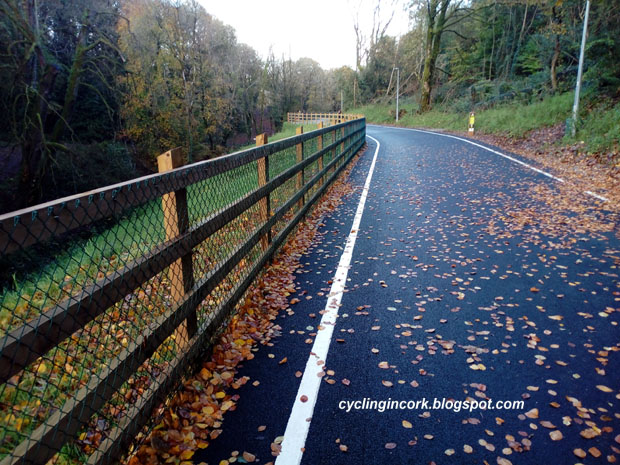
The photo above shows the same sign but also shows the road looking back up the road in the direction of Ballynoe. This is a nice quiet country road inside a wooded valley and perfect for cycling.

If we now turn around and continue the journey north, this minor road finally comes out at a T-junction on the R628 road about 3.5kms to the east of Conna.


At the right hand side of this junction, there are two direction arrows for the route. Other than a bit of lichen, it's in a very good condition and pointing in the correct directions.

The Google Streetview images from April 2009 and August 2011 show no signpost here. The August 2019 image shows the pole bent over at a 45 degree angle but it was straightened by the time of the July 2022 image. The photo above is from the start of September 2023.

Conna - Map Board : The notice board for the Blackwater Valley Cycle Route is located outside Conna Castle which is at the eastern side of the village.


This is a close up of the notice board...


This is the map on the board in Conna. It shows the route from Ballynoe and the turn north at the crossroads at Aghern.


Aghern - Map Board : The notice board for the Blackwater Valley Cycle Route is located at the Aghern Amenity Area which is a small grassy triangle on the north bank of the River Bride.


This is a photo of the notice board in August of 2023 and it looks remarkably clean for such an old sign.


This is a close up of the map and it shows the next section of the route to Fermoy.


For this one, the gradient map is actually important as there is a significant climb before dropping down into the town of Fermoy.

Right at Kenny's Crossroads : As can be seen from the map above, there is a sharp turn to the right and north on the route to Fermoy. 


This is Kenny's Crossroads. According to Google Streetview, there was a second signpost there as of September 2019 showing the directions for the Blackwater Valley Cycle Route. This signpost is missing in the July 2022 Streetview images. When I was at this location in August of 2023, the second signpost was still missing.

Entering Fermoy: The image below shows a closer view of the Blackwater Valley Cycle Route going through the town of Fermoy. The red line shows what is supposed to be the official route.


However as you enter Fermoy, there is a sign at the junction of Richmond Hill and College Road  instructing cyclists to turn right. I have this route plotted in a series of purple dots as far as the river and west then to the bridge over the River Blackwater.


The photo above shows the sign at the road junction. It's very easy to miss considering that the cyclist is coming down a steep hill, the sign is well in on the left and it's mostly obscured.


I removed some of the ivy and the sign is still in remarkably good condition.

Fermoy - Map Board : The notice board for the Blackwater Valley Cycle Route is located outside Fermoy Town Park which is on the north side of the River Blackwater.


This is the sign in more detail...


An enlarged view of the map shows the route between Aghern and Glanworth.


In Summary... After all these years, the signage for the Blackwater Valley Cycle Route from Mount Uniacke to Fermoy is still in a reasonable condition. There is certainly enough information for a cyclist to follow the route in 2023. Considering how much of the signage is intact, it's just a pity that the notice boards with maps were removed in Midleton and Youghal.

For more information on the entire route, see the overview post.